Norwegian and Estonian researchers have developed a method to map hidden meltwater paths in glaciers. Having a better understanding of how water moves inside and under the glaciers helps to better predict the motion, melting rates, and possible sudden collapses of glaciers.
This would, in turn, help coastal communities adapt to climate change, understand how coastal ecosystems will change with the increasing amount of fresh meltwater, and to better predict the rise of the global sea level.
The way into the unknown
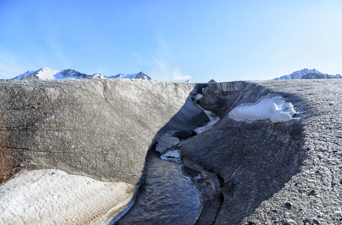
The melting ice on the surface of the glacier gets transported through large and complex channel networks inside and under the glaciers. Those channels, often resembling ferocious waterslides in a gigantic amusement park, have a large impact on the stability and the speed of the descent of the glacier. How water moves through the channel system is largely unknown because it is difficult or impossible to measure.
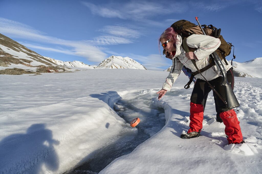
The team of researchers from University of Oslo (UiO), Tallinn University of Technology (TalTech), and Norwegian University of Science and Technology (NTNU) have developed a method, recently published in The Cryosphere, for mapping the subsurface channels using small drifters equipped with sensors carried by the water flow. The small floating drifters, about the shape, size, and weight of an average cucumber, are equipped with accelerometers, gyroscopes, and magnetometers which register the motion of the float and a satellite receiver and radio bacon for registering its position when they disappear into the glacier and reappear at the glacier outlet.
As a GPS signal cannot penetrate ice, the location of the drifter cannot be registered with a GPS receiver. The only signals that the drifter records are the acceleration and rotation of its own body with respect to the magnetic field of the Earth.
Dr Laura Piho, a mathematician from TalTech, used AI methods to analyse those signals. Drawing inspiration from research in the field of human motion analysis and robot navigation, her method searches for distinct sensor signals while drifters travel over meanders and slide and drop down waterfalls. She then estimates how they should be aligned for the drifter to travel from one point to the next. As such, she constructs the most likely path that the drifter might have travelled between registering its GPS coordinates at the channel entrance and exit.
What was the hardest part?
Dr Andreas Alexander, a glaciologist from UiO, says, ‘Now we can directly measure how water rushes though those channels with sometimes insane speeds and pressurises the base of the glacier.’
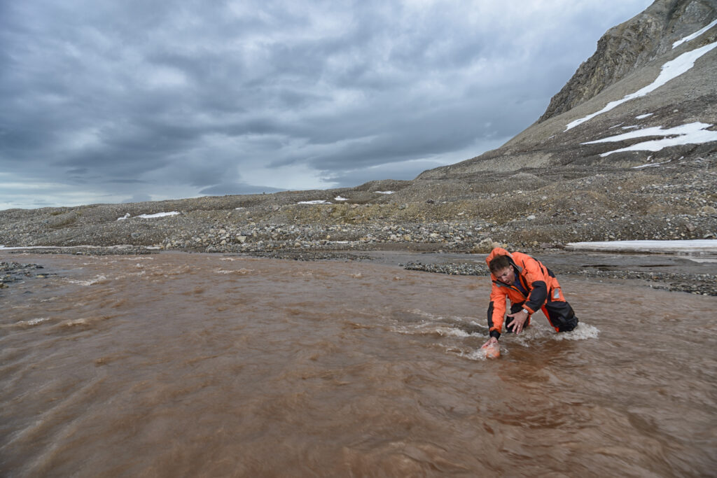
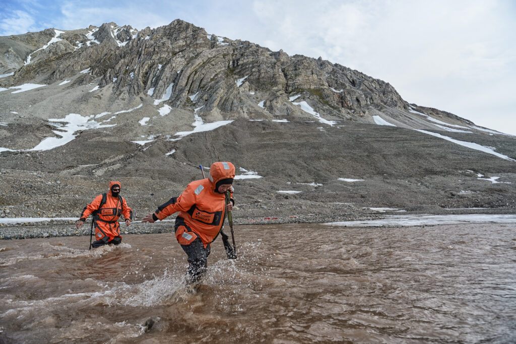
The hardest part of glaciology fieldwork, however, is usually the deployment and retrieval of equipment. The team has been testing for several summers, climbing up glaciers or sending drones to drop their devices into the glaciers. The design of the devices, developed originally at TalTech for a completely different application (measuring pressure in hydropower turbines), is especially rugged to tolerate drops from gigantic waterfalls in large glaciers and equipped with satellite receivers and radio beacons to locate them at the glacial front. Nevertheless, many of the devices get smashed in moulins (deep vertical shafts though which water enters into the glacier) or stay stuck in the gigantic hidden network of glacial rivers and lakes.
Prof Maarja Kruusmaa from TalTech and NTNU says, ‘The drifter hunt has been our most exciting and expected entertainment every summer.’
This article is written by Maarja Kruusma from Tallinn University of Technology.