Table of Contents
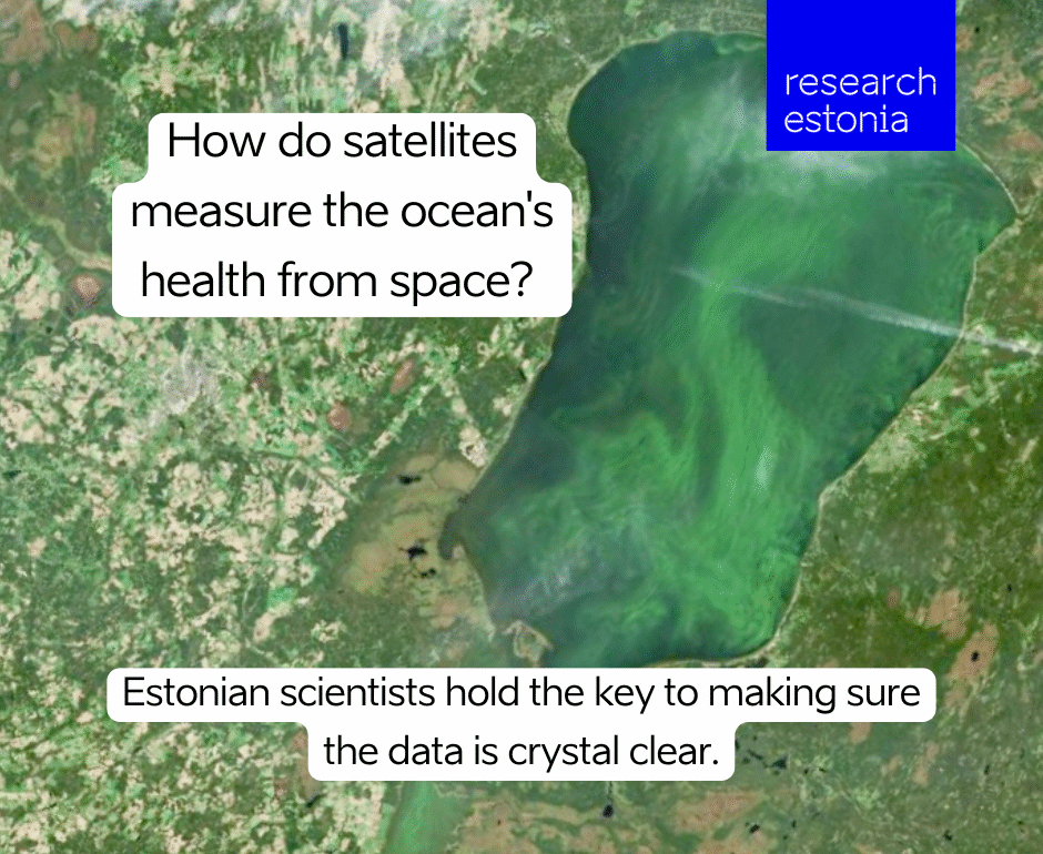
In the era of climate change, satellite imaging plays a significant role in helping to track changes in the environment. In the case of algal blooms, for example, a satellite image can determine its extent, or what kinds of phytoplankton are involved. Diverse and in-depth conclusions can be drawn from satellite images, and can also help guide scientists to sites to take measurements. But in order to get the best data out of these images, quality controlled, high fidelity measurements are necessary. This has been the goal of an international project led by University of Tartu scientists.
The project is called Fiducial Reference Measurements for Satellite Ocean Colour Phase 2, or FRM4SOC, which is a mouthful, but rolls off the tongue of lead investigator Riho Vendt, an associate professor of space technology at the University of Tartu, as well of head of laboratories at the Tartu Observatory. The latter facility, established in the 1940s and operational since, is a 20-minute drive southwest from the center of Tartu, Estonia’s second largest city.
Vendt has been involved with the project since its first phase, which ran from 2016 and 2019 and was funded by the European Space Agency. FRM4SOC has always had as its objective the improvement of ocean color measurement validation through a series of proof-of-concept tasks. These have included developing measurement protocols and organizing laboratory and field inter-comparisons in accordance with the principles and guidelines of the Committee on Earth Observation Satellites (CEOS).
A wide impact
According to Vendt, the University of Tartu’s participation in FRM4SOC was directly linked to Estonia’s accession to the European Space Agency in 2015. After the conclusion of the first project, a second phase was launched in 2021, funded by the European Commission Copernicus Programme and implemented by the European Organization for the Exploitation of Meteorological Satellites (EUMETSAT). The second phase of FRM4SOC, which has a budget of about €1.4 million, is set to conclude later this year.
Partners include the Plymouth Marine Laboratory and National Physical Laboratory in the UK; the National Research Council of Italy; the Royal Belgian Institute of Natural Sciences; ACRI-ST, a French company with expertise in earth observation; Brockmann Consult, a German company that provides environmental informatics and geoinformation services; and EOScience, a company of ocean color experts in Italy.
While the nature of the project may seem technical, Vendt sees FRM4SOC as having a much wider impact. “We want to monitor the health of our planet,” says Vendt. “When we visit doctors and we want to know about our health, we run some tests,” he says. “We want to be able to do the same for the planet and be confident in the results.”
Given the planet’s size though, he notes, it’s impossible to measure the seas and oceans on site, everywhere. With satellite observations though, scientists can cover large areas and get data from any part of the world. Should the satellite show that the Baltic Sea has become greener, scientists can go to the site indicated and take measurements, such as water samples or measurements of the light reflected from the waterbody. With such data available, they can make recommendations on the best ways to react to algal blooms. This is where accuracy counts.
“To be able to make sure that the decisions we make are right, we need to be sure the measurements are right,” says Vendt.
New tools and databases
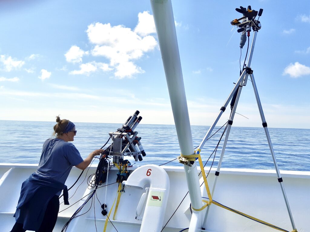
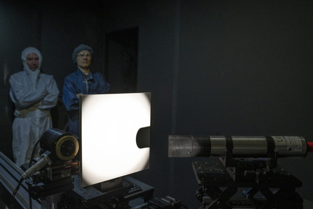
The objectives of the current phase of the FRM4SOC project are manifold. These include the development of a network of radiometric measurements that comply with fiducial radiometric measurement quality requirements. The project also seeks to set up a network of FRM-certified instruments, starting with the two most common ocean color radiometer types, such as the TriOS Ramses and Sea-Bird Scientific HyperOCR. These instruments are calibrated and characterized at the University of Tartu and may inform future studies, as the quality of radiometers continues to improve.
“Even now, new instruments are emerging,” says Vendt. “These are still radiometers based on the same working principle, but they are newer generations with improved technology.”
A community processor has also been developed to process the radiometric data in a standardized way that includes estimated measurement uncertainty. The processor, called HyperCP, was initiated by NASA’s HyperInSPACE and the University of Victoria’s PySciDON software processing packages, and is currently being conducted by an international team of expert scientists from institutions such as NASA, NPL, NOAA, EUMETSAT, PML and others.
“The evaluation of measurement uncertainty is tricky and not easy for all institutes,” says Vendt. “So a community processor comes in handy.”
During the project, investigators also developed the Copernicus Database for In Situ Ocean Colour Measurements (OCDB). The OCDB was created to maintain ocean color related in situ measurement data, and has been upgraded during the course of FRM4SOC. A second database, called the Fiducial Radiometer Database, or FidRadDB, has been created, which contains information on radiometric calibration and characterisations done on field ocean color radiometers. Initially, FidRadDB will contain all data related to the radiometers used in the FRM4SOC Phase 2 project, which have been calibrated at Tartu Observatory. In the future, data from other contexts or instruments might be included.
FidRadDB is also accessible via the HyperCP, which processes radiometric data for inclusion in FidRadDB, or extracts data from FidRadDB to obtain information about the radiometers in use.
All of the tools that FRM4SOC has developed in its different phases are publicly available, Vendt notes. “As they are developed using European Commission money, they are free for everyone to use,” he says.
Tartu as a Center of Excellence
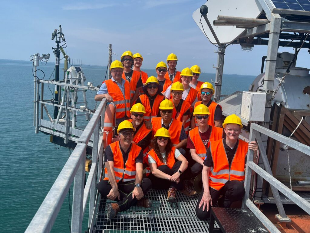
A third pillar of the FRM4SOC Phase 2 project is verifying the traceability and certainty of measurements between different institutes or operators. To do this, members of the consortium gather for comparison studies in the field. According to Vendt, FRM4SOC Phase 2 has had several of such comparisons to date and the next one is planned to be held later this year at the Acqua Alta Oceanographic Tower in the Gulf of Venice in Italy, maintained by Italy’s CNR.
At such gatherings, institutes come together with calibrated instruments, follow procedures, and their results must match within the level of uncertainty, Vendt states. Measurements taken with field radiometers are also compared to those taken with higher-level instruments to ensure accuracy.
Tartu has played a significant role, as it is the site where all of these tools are calibrated before being deployed. “Tartu has become a center of excellence, not just in Europe but in the world,” remarks Vendt. “It’s where institutes that make in situ measurements for satellite validation have their instruments calibrated.”
How Tartu came to occupy this role is probably due to a variety of factors, Vendt says, but he notes that Tartu Observatory has been operating for 60 years and has maintained research areas in astronomy and Earth observation since that time. “Some of the optical instruments used for the first spacecraft were built here in the 1960s,” he notes.
This article is written by Justin Petrone. This article was funded by the European Regional Development Fund through Estonian Research Council.
If this dive into algae has you hooked, don’t just drift with the tide! Swim over to our next article and read more about Is Seaweed a Weed or a Hidden Gem of the Sea?